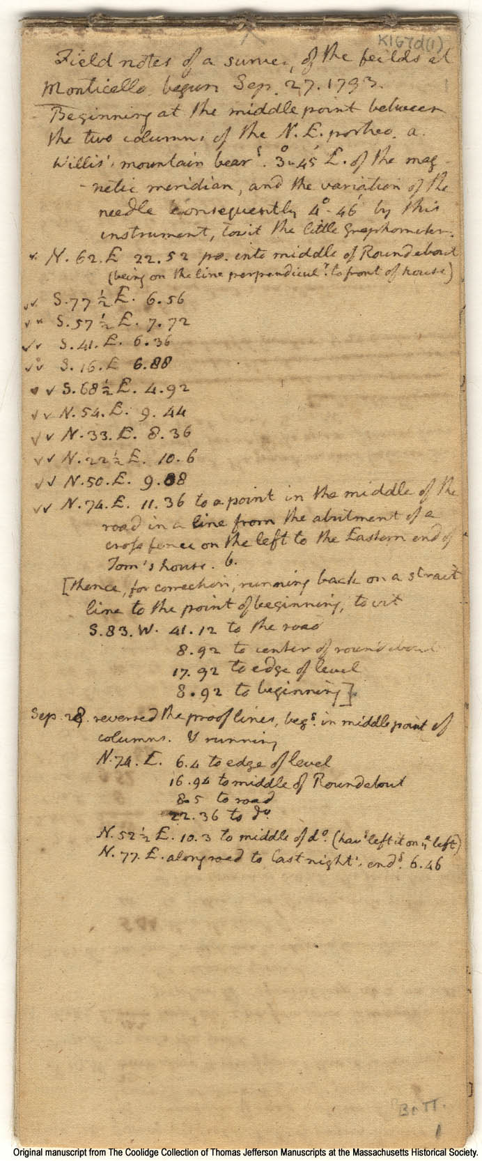
Below is an example: "Field notes of a survey of the feilds [sic] at Monticello, begun Sep. 27. 1793." It's the first page of 20 in this particular document.
Note how Jefferson starts from the steps of Monticello itself, "Beginning at the middle point between the two columns of the N.E. portico." He orients himself by "Willis' mountain," marks a juncture near the fence at "the Eastern end of Tom's house," and ultimately loops back to his beginning point--a return to Monticello (this Tom's house) and to the self who recorded these details.
The record of Jefferson's perambulation displays his rootedness in a very particular, known setting but it also demonstrates that this connection is constructed in part through the embodied performance of these abstract geographic bearings and measurements.
(The survey is the place is the surveyor.)