05 January 2012

Surveying a 17th-Century European Landscape


An example of surveying using church steeples and other tall man-made structures in an unforested landscape--a rare scenario in colonial North America.

From Bernhard Cantzler and Abdias Trew, Summa geometricae practicae worinnen ernstlich Bernhard Cantzlers kurtzer und leichter Bericht von Feldmessen, Auf die ins gemein vor andern fürkommende Fäll deß Messens und Abtheilens gerichtet, Zum Andern, Unterschiedliche auf heutigen Schlag in Frieden und Kriegszeiten zu Land und Wasser nützliche Annotationes ...(Nürnberg, 1663).

(Image from the scanned edition held by the Bayerische Staatsbibliothek. The color scan at Google Books is very nice, too. The latter is in the "Surveying Library" I mentioned below.)

03 January 2012

Churches & Turbines

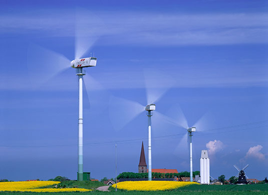
Driving through the Rhine Valley yesterday gave me a new insight into the difficulty of transmitting survey techniques from Europe to the Americas during the colonial era. As one travels along European highways, often the most notable signs of historic settlement are the church towers that rise up one after another along the horizon. (To judge from Germany today, the landscape of the future will be marked by towering turbines wherever a stiff breeze can be found.)

Fehmarn Island, northern Germany

Early modern surveying manuals often indicate that surveyors used such church towers and other tall urban structures (including windmills, the monstrous turbines of that age) to orient their surveys. The seventeenth-century Dutch painting I've used as a backdrop offers an example of this practice.

But in most early American settings where surveyors worked, there were few buildings, and few churches, that could serve such a purpose, and it was unlikely that a surveyor could get a clear view of such a building in those few areas where one may have existed. In the excerpt of Jefferson's survey included in the last post, we see him start his survey by sighting "Willis' mountain," not a church spire. Measurement of the land required American surveyors to engage with "wilderness" in a way that most European surveyors did not.

01 January 2012

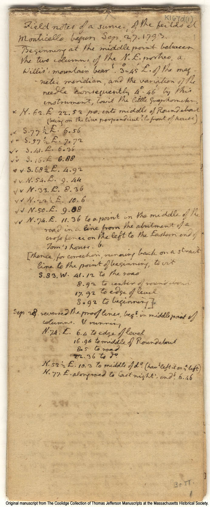
Jefferson's Field Notes, 1793

The Massachusetts Historical Society has a wonderful online collection of materials related to Thomas Jefferson's surveying activities. The best way to explore them is to go to the "Architectural Drawings" collected here and search for terms such as "survey" or "plat."

Below is an example: "Field notes of a survey of the feilds [sic] at Monticello, begun Sep. 27. 1793." It's the first page of 20 in this particular document.

Note how Jefferson starts from the steps of Monticello itself, "Beginning at the middle point between the two columns of the N.E. portico." He orients himself by "Willis' mountain," marks a juncture near the fence at "the Eastern end of Tom's house," and ultimately loops back to his beginning point--a return to Monticello (this Tom's house) and to the self who recorded these details.

The record of Jefferson's perambulation displays his rootedness in a very particular, known setting but it also demonstrates that this connection is constructed in part through the embodied performance of these abstract geographic bearings and measurements.

(The survey is the place is the surveyor.)


30 December 2011

Surveying Library

For a collection of online texts related to surveying in early modern Europe and the Americas, take a look at this small "Surveying Library" I've been putting together on Google Books.

29 December 2011

To make a start

To make a start,
out of particulars
and make them general, rolling
up the sum, by defective means--

     --William Carlos Williams, Preface to Paterson, Book I.

The Compleat Surveyor is an experiment, an attempt to create a collaborative workspace for a new interdisciplinary research project about land surveyors in early modern Europe and colonial North America. It is a place for collecting resources, recording observations, and making connections. These are my field notes. Welcome.